

![English [GB]](../../../language/en_GB/en_GB.jpg "English [GB]")
![English [US]](../../../language/en_US/en_US.jpg "English [US]")
![Nederlands [NL]](../../../language/nl_NL/nl_NL.jpg "Nederlands [NL]")
)
)
)
)
)
)
)
)
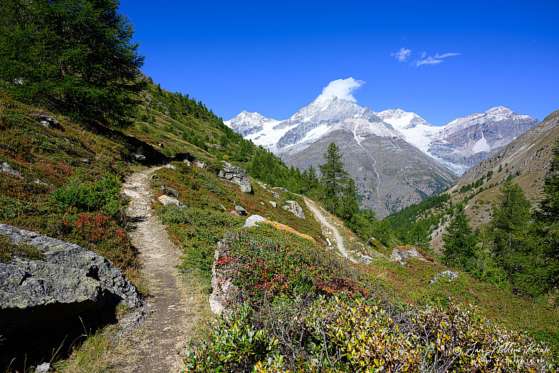
Alphubel above the Täschalp–Tufteren High Trail
Camera brand and type used to take photo
 NIKON Z 9
Lens used
NIKON Z 9
Lens used
 NIKKOR Z 24-120mm f/4 S @ 24 mm
NIKON Z 9
Lens used
NIKKOR Z 24-120mm f/4 S @ 24 mm
Aperture used
 f/8.0
Exposure used
f/8.0
Exposure used
 1/200 s
Exposure compensation applied
1/200 s
Exposure compensation applied
 0.0 EV
ISO used
0.0 EV
ISO used
 64
64
f/8.0
Exposure used
1/200 s
Exposure compensation applied
0.0 EV
ISO used
64
Photo Info
fgk-20250831-001-Z9-9560-Weisshorn (4505m)_-alphubel-taschalp-tufteren-trail-tasch-swiss-alps.jpg
2560*1707
(1773 KB)
132x visited
Description
Headline
Alphubel above the Täschalp–Tufteren High Trail
Caption
An Alpine hiking trail crosses larch-covered slopes beneath the glaciated Alphubel above Täsch, with high Pennine peaks filling the horizon.
Image Alt text
Narrow Alpine hiking trail through larches with the snow-covered Alphubel ahead.
Event
-
Keywords
Capture info
(IPTC Instructions)
(IPTC Instructions)
Metadata generated by ChatGPT GPT-5.6 Sol at 17-Aug-'26 00:03 with AI Photo Metadata Grabber ChatGPT v1.23.5 (96% confidence). Location Created GPS based (92% confidence). Location Shown estimated (97% confidence). GPS position source GPS (100% confidence
Location
Location
- - - -
Altitude
2206 meter
Properties
Original filename
001-Z9-9560-Weisshorn (4505m)_.jpg
Taken on
31-Aug-2025 11:09:04
Scanned on
31-Aug-2025 11:09:04
Digital Source
Unknown
Posted first on
17-Aug-2026 00:06:21
Update posted on
17-Aug-2026 00:06:22
Rating/label
Adobe Lightroom
Adobe Lightroom
Label and rating as set in Adobe Lightroom
Rating score
no rating
Update rating
Rate this photo
Copyright
Credit line
-
Copyright
-
Copyright Notice
-
Photographer
Jan-Willem Kruse
Other Info
Related albums
Job identifier
-
0 comments